


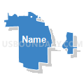
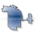
Wd 41 Pct 27, Cook County, Illinois
About
Outline

Summary
| Unique Area Identifier | 569052 |
| Name | Wd 41 Pct 27 |
| County | Cook County |
| State | Illinois |
| Area (square miles) | 8.96 |
| Land Area (square miles) | 8.82 |
| Water Area (square miles) | 0.14 |
| % of Land Area | 98.45 |
| % of Water Area | 1.55 |
| Latitude of the Internal Point | 41.97959690 |
| Longtitude of the Internal Point | -87.89749600 |
Maps


Graphs
Select a template below for downloading or customizing gragh for Wd 41 Pct 27, Cook County, Illinois


Neighbors
Neighoring Voting District (by Name) Neighboring Voting District on the Map
- ADDISON 10 Voting District, DuPage County, IL
- ADDISON 28 Voting District, DuPage County, IL
- Elk Grove 17 Voting District, Cook County, IL
- Elk Grove 36 Voting District, Cook County, IL
- Leyden 1 Voting District, Cook County, IL
- Leyden 12 Voting District, Cook County, IL
- LEYDEN 33 Voting District, Cook County, IL
- Leyden 38 Voting District, Cook County, IL
- LEYDEN 74 Voting District, Cook County, IL
- Leyden 77 Voting District, Cook County, IL
- Leyden 79 Voting District, Cook County, IL
- Leyden 85 Voting District, Cook County, IL
- Leyden 86 Voting District, Cook County, IL
- Maine 41 Voting District, Cook County, IL
- Maine 56 Voting District, Cook County, IL
- Maine 66 Voting District, Cook County, IL
- Wd 36 Pct 17, Cook County, IL
- Wd 41 Pct 25, Cook County, IL
- Wd 41 Pct 26, Cook County, IL
- Wd 41 Pct 28, Cook County, IL
- Wd 41 Pct 48, Cook County, IL
Top 10 Neighboring County Subdivision (by Population) Neighboring County Subdivision on the Map
- Chicago city, Cook County, IL (2,695,598)
- Maine township, Cook County, IL (135,772)
- Elk Grove township, Cook County, IL (92,905)
- Leyden township, Cook County, IL (92,890)
- Addison township, DuPage County, IL (88,612)
- Chicago city, DuPage County, IL (0)
Top 10 Neighboring Place (by Population) Neighboring Place on the Map
- Chicago city, IL (2,695,598)
- Des Plaines city, IL (58,364)
- Park Ridge city, IL (37,480)
- Elk Grove Village village, IL (33,127)
- Bensenville village, IL (18,352)
- Franklin Park village, IL (18,333)
- Norridge village, IL (14,572)
- Schiller Park village, IL (11,793)
- Rosemont village, IL (4,202)
Top 10 Neighboring Elementary School District (by Population) Neighboring Elementary School District on the Map
- Community Consolidated School District 59, IL (65,398)
- Des Plaines Community Consolidated School District 62, IL (51,614)
- Park Ridge Consolidated Community School District 64, IL (40,255)
- Mannheim School District 83, IL (21,187)
- Bensenville School District 2, IL (19,502)
- Schiller Park School District 81, IL (13,266)
- Norridge School District 80, IL (12,288)
- Pennoyer School District 79, IL (5,622)
- Rosemont Elementary School District 78, IL (2,360)
Top 10 Neighboring Secondary School District (by Population) Neighboring Secondary School District on the Map
- Township High School District 214, IL (251,203)
- Maine Township High School District 207, IL (144,788)
- Leyden Community High School District 212, IL (64,119)
- Fenton Community High School District 100, IL (29,995)
- Ridgewood Community High School District 234, IL (19,327)
Top 10 Neighboring Unified School District (by Population) Neighboring Unified School District on the Map
Top 10 Neighboring State Legislative District Lower Chamber (by Population) Neighboring State Legislative District Lower Chamber on the Map
- State House District 20, IL (105,228)
- State House District 65, IL (105,147)
- State House District 66, IL (104,069)
- State House District 77, IL (100,987)
Top 10 Neighboring State Legislative District Upper Chamber (by Population) Neighboring State Legislative District Upper Chamber on the Map
- State Senate District 10, IL (209,688)
- State Senate District 33, IL (209,216)
- State Senate District 39, IL (201,567)
Top 10 Neighboring 111th Congressional District (by Population) Neighboring 111th Congressional District on the Map
- Congressional District 6, IL (657,131)
- Congressional District 5, IL (648,610)
- Congressional District 9, IL (628,859)
Top 10 Neighboring Census Tract (by Population) Neighboring Census Tract on the Map
- Census Tract 7608.03, Cook County, IL (6,236)
- Census Tract 8116, Cook County, IL (6,213)
- Census Tract 7708, Cook County, IL (5,582)
- Census Tract 7706.02, Cook County, IL (4,956)
- Census Tract 7705, Cook County, IL (4,078)
- Census Tract 7608.01, Cook County, IL (4,047)
- Census Tract 8117.01, Cook County, IL (3,858)
- Census Tract 7709.02, Cook County, IL (3,521)
- Census Tract 8066, Cook County, IL (3,490)
- Census Tract 8400, DuPage County, IL (2,999)
Top 10 Neighboring 5-Digit ZIP Code Tabulation Area (by Population) Neighboring 5-Digit ZIP Code Tabulation Area on the Map
- 60068, IL (37,475)
- 60007, IL (33,820)
- 60018, IL (30,099)
- 60631, IL (28,641)
- 60656, IL (27,613)
- 60706, IL (23,134)
- 60106, IL (20,309)
- 60131, IL (18,097)
- 60176, IL (11,795)